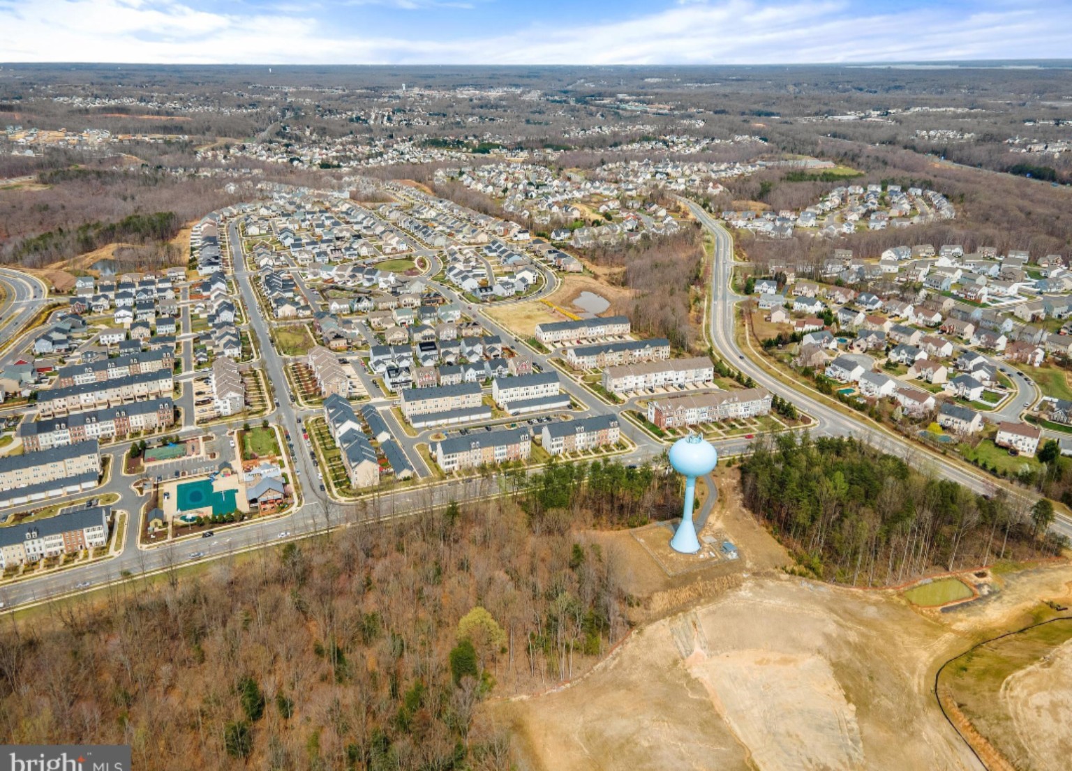
Stafford County is making decisions now that could help determine what the community looks like in 2046.
On September 9, the Stafford County Planning Commission voted six to one to recommend the proposed 2026 through 2046 Comprehensive Plan update to the Board of Supervisors.
The recommendation includes several issues likely to attract public attention, including a proposed Cool Springs dining and retail concept, another look at the former Cannon Ridge Golf Course property and disagreement over future transportation corridors shown as dashed lines on County maps.
But those individual issues are only pieces of a much larger decision.
The Comprehensive Plan establishes Stafford's long range recommendations for development, transportation, housing, public facilities, environmental resources and other aspects of growth.
Adopting the plan does not automatically rezone property or approve construction. However, future land use applications may be evaluated against the vision Stafford adopts today.
What is a Comprehensive Plan?
A Comprehensive Plan is not the same as zoning. If the plan identifies an area for possible business or residential development, that does not necessarily mean a developer can immediately build there.
Comprehensive Plan: Where and how should Stafford develop over the long term?
Zoning: What can legally be built on a particular property today?
Rezoning or Conditional Use Permit: Should Stafford authorize a different use or development pattern?
Site plan: How will an approved project actually be arranged and constructed?
Changing a line or color on the Comprehensive Plan map may not immediately change what exists on the ground. But when a future rezoning or development proposal arrives, consistency with Stafford's adopted plan can become part of the County's evaluation.
Why is Stafford updating the plan now?
Virginia requires local planning commissions to review their comprehensive plans at least once every five years and determine whether changes are advisable.
Stafford has spent much of 2026 conducting that review through subcommittee meetings, chapter revisions, population information, transportation planning, housing discussions, public input and proposed changes to future land use recommendations.
By August, Stafford had assembled those revisions into a consolidated proposed plan. The Planning Commission recommended the update on September 9. The Board of Supervisors will ultimately decide what version Stafford adopts.
Stafford is planning for considerable growth
The County directs much of its anticipated growth toward the Urban Services Area, where public utilities and services are more readily available.
Within that area are Targeted Development Areas, commonly called TDAs. These areas are intended to accommodate significant portions of Stafford's future residential and commercial growth.
That is why changes to a TDA boundary or future land use designation deserve public attention. A change that appears small on a map can represent a substantial change in long term development expectations.
Chatham and Berea were reconsidered
During the 2026 review, Stafford's Comprehensive Plan subcommittee examined future land use recommendations involving the Chatham and Berea Targeted Development Areas.
The existing Berea planning concept contemplates approximately 1,650 additional homes, including single family homes, townhouses and multifamily housing. It also envisions approximately 3.75 million square feet of business development.
Previous County planning analysis estimated that 1,650 homes could produce approximately 5,115 additional residents.
Growth creates demand for schools, roads, fire and rescue services, parks, libraries, water systems and sewer infrastructure.
If Stafford changes where growth is planned, how will the infrastructure assumptions and public costs change with it?
Cool Springs could receive a new identity
One of the more noticeable ideas emerging from the Planning Commission process is a Cool Springs dining and retail concept.
This should not be confused with approval of a particular shopping center, restaurant or development project. A Comprehensive Plan concept establishes long term planning direction. Individual projects would still need to proceed through the applicable review processes.
The important questions are which properties are included, how the concept differs from the existing plan and what type of development Stafford intends to encourage there.
Cannon Ridge is back in the discussion
The former Cannon Ridge Golf Course also received renewed attention during the Comprehensive Plan process.
Previous County planning documents contemplated a Cannon Ridge Trail as part of a larger pedestrian and recreational network connecting areas around Celebrate Virginia North, Cannon Ridge, the Rappahannock River and the Belmont and Ferry Farm trail system.
A Comprehensive Plan recommendation is not a zoning change. Changing a planning designation is not the same as purchasing property. Identifying land for possible recreational use does not automatically turn privately owned land into a public park.
What do the dashed roads mean?
The September 9 discussion included disagreement over dashed lines representing possible future road corridors.
A conceptual road on a Comprehensive Plan map is different from a funded construction project. Before construction could occur, additional steps could include engineering, environmental analysis, funding, right of way acquisition and further government approvals.
However, the lines are not meaningless. Placing a transportation corridor in Stafford's long range planning framework can preserve the concept for future study, funding and investment.
The river crossing and Outer Connector need context
Stafford's broader transportation planning has considered another Rappahannock River crossing, an Outer Connector and other western transportation improvements.
These are long range transportation concepts, not approved construction projects. A corridor can remain on a planning map for many years without receiving funding or being built. Still, the plan is one place where Stafford decides whether those possibilities remain part of its long term vision.
Housing is also part of the rewrite
The review is not limited to roads and development maps. Stafford also reviewed its housing policies.
Virginia law requires comprehensive plans to address affordable housing. State law also requires certain manufactured housing strategies to be considered when plans are amended. Stafford's working materials included housing revisions and information developed through its workforce and affordable housing efforts.
A new environmental justice requirement arrived during the review
Beginning July 1, 2026, Virginia law requires counties with populations above 100,000 to consider adopting an environmental justice strategy during their next scheduled Comprehensive Plan review.
The law addresses environmental justice communities, fenceline communities, pollution sources, air and water quality, flooding, excessive heat, public facilities, parks, transportation and civic participation.
The law requires Stafford to consider adopting a strategy. It does not require the County to adopt every possible environmental justice policy. The final plan should clearly explain how Stafford addressed the requirement.
What about data centers?
The Comprehensive Plan does not approve individual data centers. However, future land use classifications, Urban Services Area boundaries, industrial areas, roads and electrical infrastructure can all become relevant when major projects are proposed.
Virginia law permits comprehensive plans to identify corridors or routes for electric transmission lines rated at 150 kilovolts or more. The final land use, transportation and infrastructure maps are therefore especially important as Stafford continues debating data centers and the infrastructure associated with them.
The biggest question may be what growth will cost
Virginia law allows a Planning Commission, while reviewing a Comprehensive Plan, to study the public facilities that would be needed if the plan were fully implemented.
That study may estimate future costs and revenues associated with schools, roads, water and sewer systems, public safety facilities and other infrastructure.
If Stafford is deciding where the next 20 years of growth should occur, what will providing the necessary infrastructure cost?
Development can generate tax revenue. It can also create additional demand for public services. A serious long range growth discussion should examine both sides of that equation.
Questions that still need clear answers
- How do the new population and housing projections compare with those in the existing plan?
- Exactly how did the Chatham and Berea TDA boundaries or recommendations change?
- Which properties are included in the Cool Springs concept?
- What exact treatment is being recommended for Cannon Ridge?
- Which future road corridors were added, removed or relocated?
- What infrastructure would be required if the new plan were fully developed?
- Has Stafford compared the revenue expected from projected growth with the resulting County expenses?
The latest draft may not be the final version
The latest complete consolidated draft identified during this review is dated August 6, 2026.
Because additional changes were discussed before the September 9 recommendation, the August draft should not automatically be treated as identical to the version that will ultimately reach the Board.
The document residents should compare with Stafford's existing Comprehensive Plan is the final version presented to the Board of Supervisors for adoption.
What happens next matters more than the September vote
The Planning Commission's recommendation was an important milestone, but it was not the end of the process. The Board of Supervisors may adopt, amend or reject the plan after the required public process.
A subdivision proposed years from now may be evaluated against this plan. A developer requesting a rezoning may point to this plan. A future road corridor may already appear on this plan. Commercial or industrial growth may be directed toward areas identified in this plan.
The bigger question
The question facing Stafford is not simply whether the County will grow. Growth has been part of Stafford's story for decades.
The more important questions are where that growth should go, how dense it should be, what infrastructure it will require, how much that infrastructure will cost and what areas should remain protected.
Most importantly, does the plan Stafford adopts today match the Stafford that residents want to live in 20 years from now?
Sources, documents & image credits
Read the original record
Stafford County Comprehensive Plan update meetings and materials2026 review record · Open original source ↗Stafford County Planning CommissionSeptember 9, 2026 meeting record · Open original source ↗Virginia Code § 15.2-2223Comprehensive plan scope and transportation planning · Open original source ↗Virginia Code § 15.2-2230Five year review requirement · Open original source ↗Virginia Code § 15.2-2230.1Public facilities cost and revenue study · Open original source ↗Virginia Code § 15.2-2223.62026 environmental justice strategy requirement · Open original source ↗Virginia Code § 15.2-2226Board adoption process · Open original source ↗Support Save Stafford
Independent local information. No paywalls. No advertising.Research like this takes time and sometimes requires obtaining public records. Community support helps Save Stafford continue making this information freely available.
No subscription required. Contribute only if you choose. Financial contributions do not purchase editorial influence.